Scientists from the National Center of Archeology of UzAS together with specialists from the Institute of Physics of the Earth named after O. Yu. Schmidt RAS, along with scientists from the Institute of Seismology UzAS, for the first time conducted archaeoseismological field studies in the Fergana Valley in order to clarify its seismic hazard and compile a summary of the most powerful earthquakes that took place in this area. The objects of study were such large monuments as Akhsikent, Eilatan, Kuyultepa, Mugkala, Mugtepa and Kyrkhujra, which were damaged or completely destroyed at different times as a result of the seismic activity of the region. The research results are presented in a series of articles in well-known scientific journals.
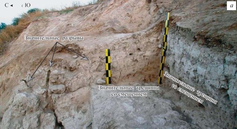
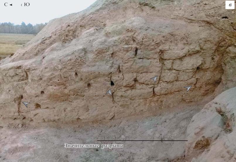
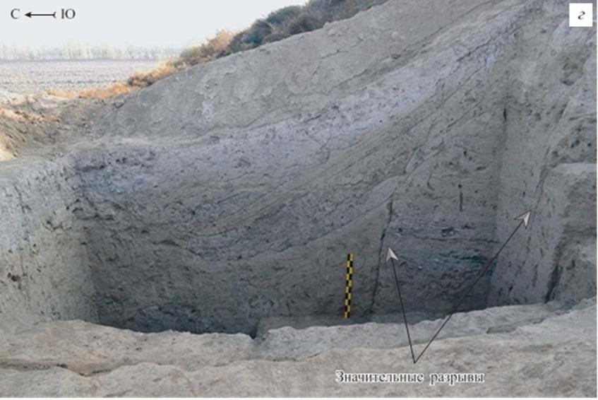
The ancient city of Eilatan was destroyed in the I st century. B.C. due to a strong earthquake, the intensity of which, judging by the calculations, was 10. Residents left the city and built new settlements nearby, one of which was Kuyultepa, but it was also destroyed during an earthquake with a magnitude of 8-9. On the left bank of the Kasansay river, in the Kasansay district of the Namangan region, there are two monuments Mugkala and Mugtepa, on which damages of a seismogenic nature are also observed. It is worth noting that the builders of Mugkala knew about the seismic risks in the Fergana Valley and built structures using anti-seismic techniques, for example, they laid large rounded stones in the foundation of the fortress walls. There is also article dedicated to the settlement of Kirkhudjra, which in the 90s. BC. suffered, and at the end of IVth-Vth century A.D. was abandoned as a result of strong earthquakes. As well as for the sites presented above, the plan of Kirkhudjra and a detailed description of the deformations of the site that have seismogenic character are given.
Each article gives a short but capacious outline of the geological-tectonic and seismological study of the region. In addition, there are chapters devoted to the historical and archaeological research of the considered monuments, along with the history of seismic activity of the entire region.
A significant component of each article is the results of archaeoseismological studies, which describe in detail the processes of the impact of earthquakes on buildings and give a detailed description of all types of damage, on monuments that manifested themselves as a result of tectonic activity, a number of signs are also listed, when found on a site, one can speak of their seismogenic origin, among them: systematic tilting of walls, pinholes in walls, continuous cracks, extended interbrick cracks, disintegration of walls.
This research is the first attem
pt to study the seismological activity of the region based on archaeological sites in the Fergana Valley. In the course of the work, data were obtained that make it possible to expand knowledge about the seismic history of the region, and they show an error in assessing the seismic hazard of the territory of the basin itself. Further research can help in constructing a new map of the seismic zoning of the region.
Please find articles on the following links:


